OT Moustiers
A great route to discover the summits of Montdenier with a magnificent 360° view. This is a demanding tour, requiring a long day's walking. It is reserved for good walkers used to long efforts and totally autonomous hikes.
After an initial climb to Vincel, you will reach the Montdenier campsite. Head for the Agra summit, passing through Naverre and the Mouresse ravine.
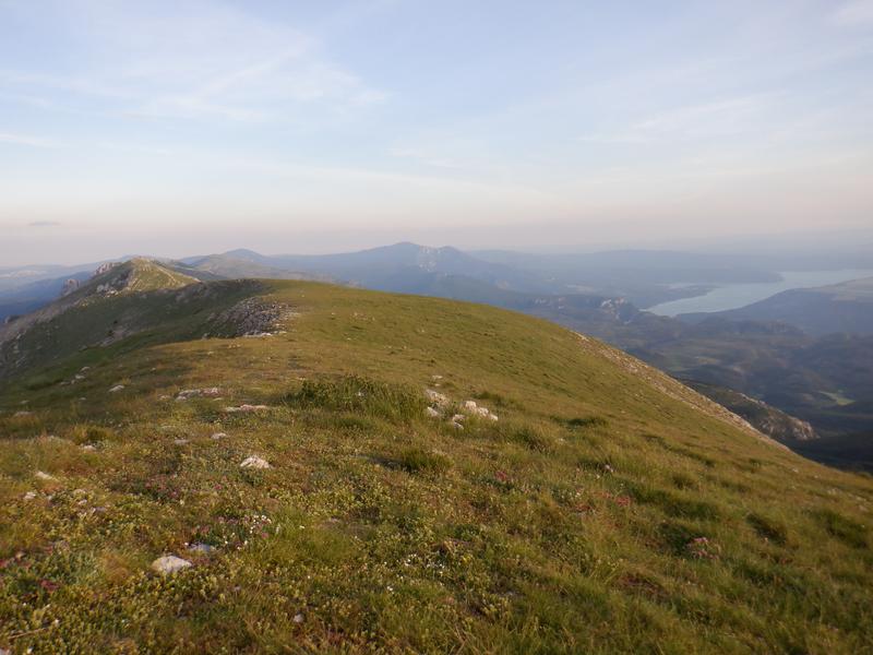
From l'Agra (1523m altitude), you can enjoy a stunning 360° panorama, including a view of the summit of Montdenier (1750m altitude) and the uphill route to get there.
To reach the summit of Montdenier, stay on the signposted PR® trail leading to the Col de la Cabane.
Here you can enjoy an exceptional panoramic view of the Lac de Sainte-Croix, Mont Chiran and the Mourre de Chanier. You can also catch a glimpse of the Montagne de Lure, the Ventoux and the Vaucluse mountains.
For the return way, go back to the Col de la Cabane then follow the signs for Marignol and its old sheepfold. At this point, the descent will take you back to the Montdenier campsite. Turn left onto the tarmac road. You will return to the village via Pierrefeu and the magnificent descent along the Courchon path.
32.4km · 1450m D+ · 11/12h
Rates
Free access.
Practical information
- Car park
Environments
- Presence of livestock and guard dogs
- Lake view
- Mountain view
- Panoramic view