

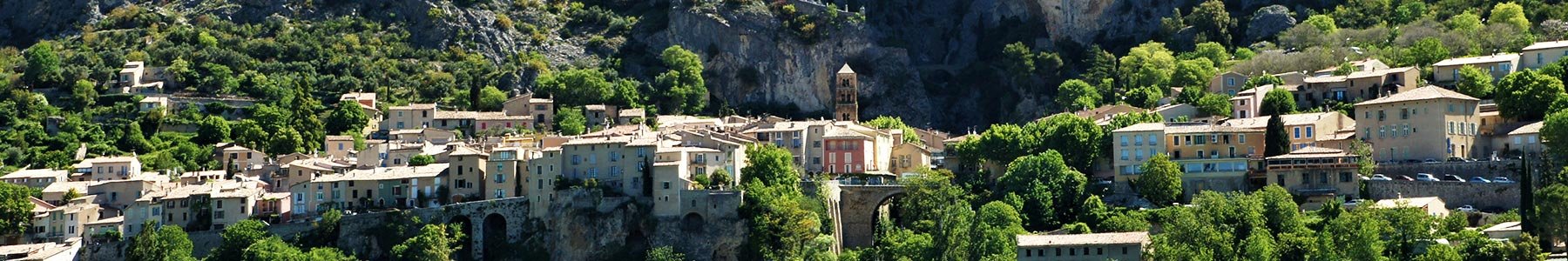
You are staying in Moustiers and do not have a car ?
Or you would like to use public transport as much as possible, for obvious ecological reasons?
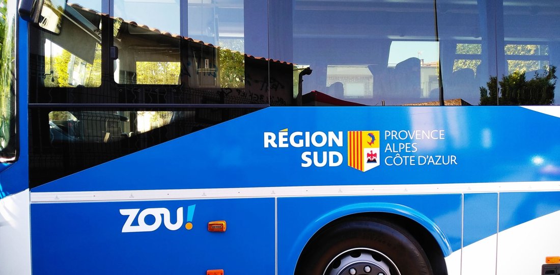
→ Good news: the "ZOU!" transport network of the South Provence-Alpes-Côte d'Azur Region allows you to access a large number of superb hiking routes in the Verdon Park by bus with the BV1 line (Riez and Castellane via Moustiers!)
The list of the different hikes that we propose on this page is not exhaustive but forms a very relevant proposal for your stay in our town!
With this small "catalog" of itineraries, widen your possibilities and go for magnificent hikes in the Verdon Park. These itiniraries are perfectly complementary to the rich offer of hikes starting from our village of Moustiers...
→ It is up to you to carefully consult the descriptions on the two major websites Cheminsdesparcs.fr and Rando-alpes-haute-provence.fr to find the itineraries that perfectly match your hiking habits and what you are looking for, both in terms of walking time and difficulty level.
Finally, we advise you to equip yourself according to the characteristics of the chosen itinerary (duration + difficulty of the terrain) and to take some margin in order to make sure not to miss the bus or the shuttle you wish to take.*
* times mentioned are given as an indication and correspond to the speed of an average walker.
Between Moustiers and Castellane : accessible hikes via the BV1 line
Between our village of Moustiers-Sainte-Marie and Castellane, the BV1 line operates during the 2021-2022 school year, from April 9 to November 16, (see "timetable" BV1). From the end of June to the beginning of September, three additional trips are offered daily to allow you to reach the starting points of the hiking routes proposed below during the summer season!
• Note: to go to Castellane, the stop called "Déviation village RD952" is at the foot of our village, along the road and just above the camping-cars area (GPS coordinates 43.84363, 6.21940).
starting points
Accessible hiking itinerary(s)
Lenght
Level of difficulty
La Palud-sur-Verdon →
⚠️ Warning : for this hike, it is necessary to rely on the "shuttle Blanc-Martel" services → See further down on the page the period of operation of this shuttle.
7h
7h
Difficult
Difficult
Between Moustiers and Riez : accessible hikes via the BV1 line
Unlike the Moustiers-Castellane section, the BV1 line operates all year round between Moustiers and Riez! Two daily trips are offered each day from the "Village" stop in Moustiers (located in the heart of our village, in front of the Musée de la Faïence): one during the school year and the other all year round, except on public holidays. (cf. "timetable" BV1).
Additional trips are offered from April to November from the " Déviation village RD952" stop, located just below our village (GPS coordinates 43.84363, 6.21940).
starting points
Accessible hiking itinerary(s)
Lenght
Level of difficulty
Roumoules →
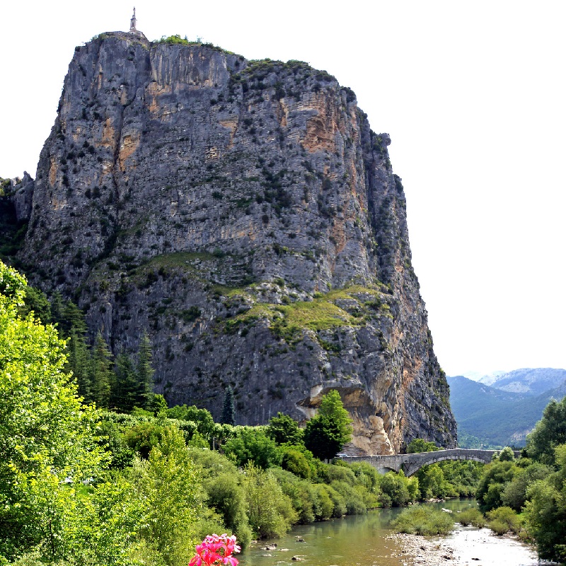
Return trip Roumoules ↔ Riez on the GR® 4 via the Sainte-Maxime chapel
⚠️ Warning: no description sheet for this itinerary... → From the RD952 stop, first take the "Route de Puimoisson" for a few hundred meters, then the GR® 4 towards Riez. Join the center of "Riez la Romaine" and the "Allée Louis Gardiol" via the Sainte-Maxime chapel. The return itinerary is identical to that of the first trip.
3h
⚠️ For the full return trip Roumoules ↔ Riez. That is ~9km of distance.
Easy
Riez →
30 mn
1h30
3h
Very easy
Very easy
Easy
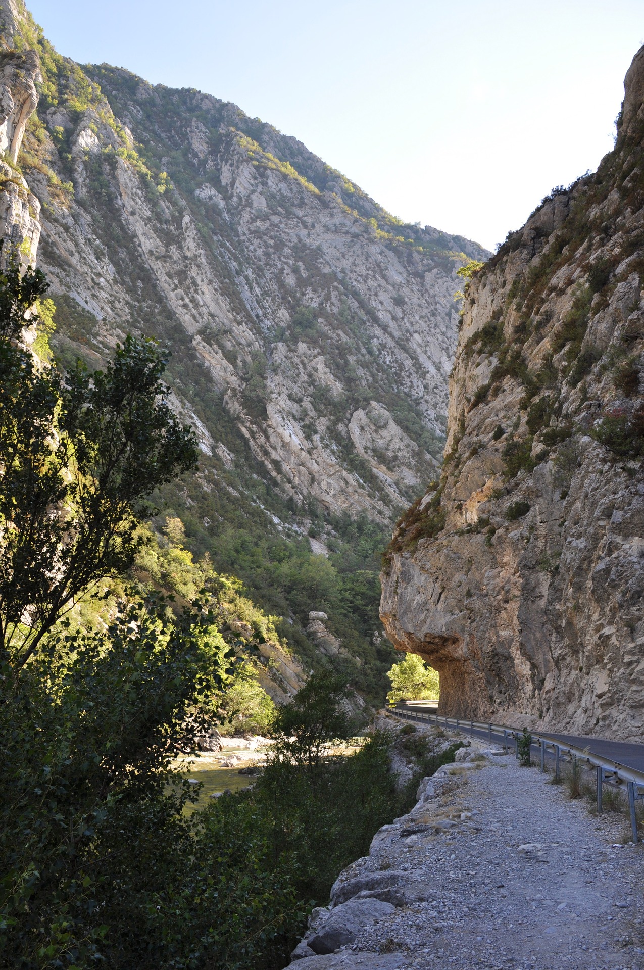
La "Blanc Martel shuttle"
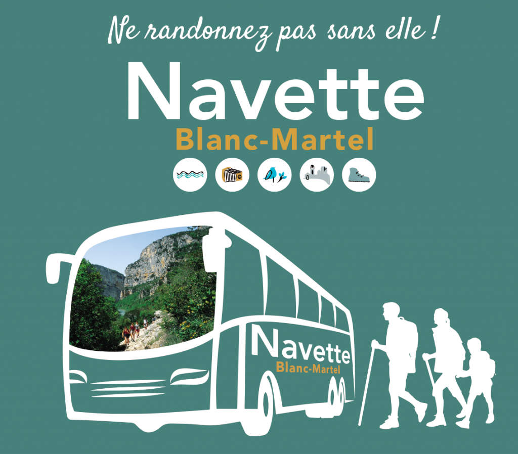
The "Blanc-Martel shuttle" allows you to do THE mythical hike of the Verdon Gorges !
This itinerary is a one-way trip of about 13 km between the chalet de la Maline and the Point Sublime (see the description to know more about this famous hike of the "sentier Blanc-Martel") ►
https://www.cheminsdesparcs.fr/walking/the-trail-of-blanc-martel/
The shuttle allows hikers to go from La Palud-sur-Verdon to the chalet de la Maline to strat the hike, and from Point Sublime to La Palud-sur-Verdon for the return journey; and thus gives you the possibility to easily organize the necessary transportation for this itinerary. ☺
For any question regarding the services of this "Blanc-Martel shuttle", please contact directly the Maison du Parc naturel régional du Verdon (located in Moustiers) which is in charge of this transport service...↓
04 92 74 68 00 |
| www.parcduverdon.fr
• Note: The shuttle is currently taking a winter break and will be available to hikers next spring! The shuttle will run until the beginning of November, with an increased daily service in July and August.
⚠️ Warning : the BV1 bus line (between Moustiers and Castellane) and the "Blanc-Martel shuttle" do not operate all year round... → Consult the official websites of the transporters before embarking on one of the hikes proposed on this page and in order to make sure that you can indeed count on the transport services in question ! (https://zou.maregionsud.fr/ & https://navette.parcduverdon.fr/)
☺
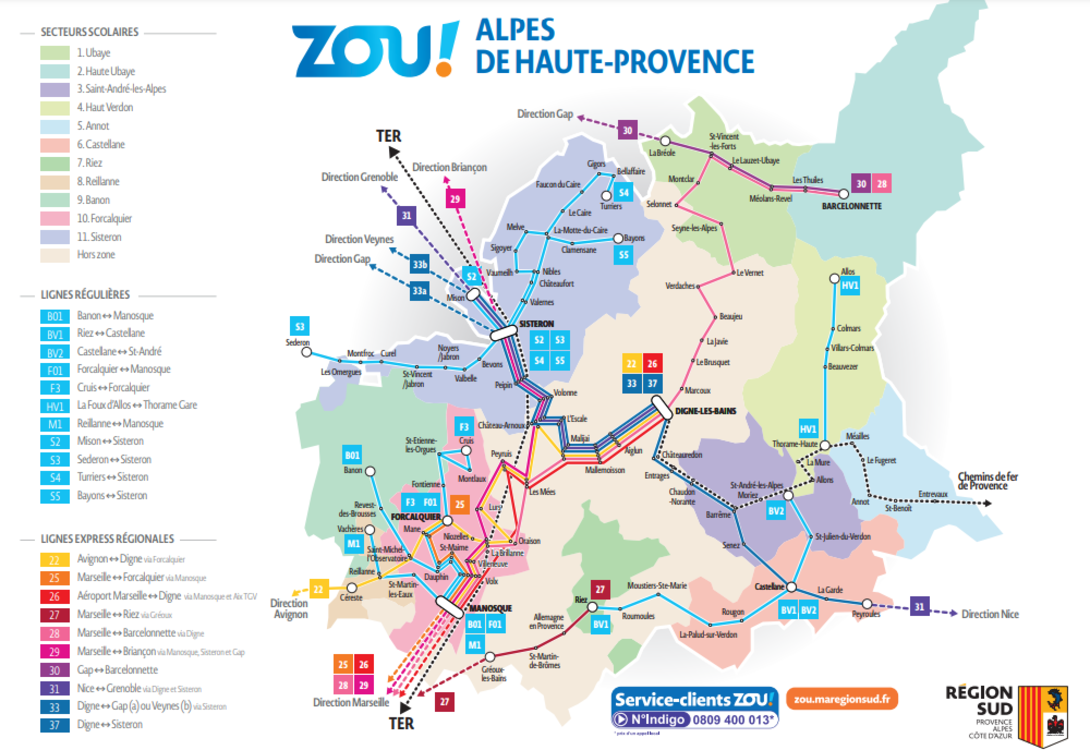
+ ZOU ! – Alpes de Haute Provence route maps :
for more mobility throughout the territory of the department!
 | Moult bus ZOU! dans les Alpes-de-Haute-Provence !
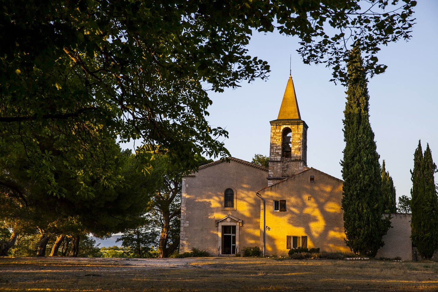
Crédits photos : ©AD04-Thibaut Vergoz (photo chapelle Saint-Maxime de Riez) | ©zou.maregionsud.fr (photo principale et "plan des lignes") |
©parcduverdon.fr (visuel navette Blanc-Martel)